The RAPID Facility

RAPID Training

Science Plan


Next-Generation Science and Engineering Reconnaissance to Enhance Community Resilience
The RAPID Facility provides researchers with state-of-the-art reconnaissance instrumentation and technical expertise to collect critical disaster data, informing science, engineering and policy to strengthen community resilience.
100+ unique deployment locations
70+ collaborating institutions served
20 types of hazards and disasters supported
850+ researchers trained on RAPID equipment
200+ reconnaissance missions supported
160+ publications using RAPID data
Recent RAPID Projects
Our drone-mounted aerial lidar scanners were recently deployed to the site of the 2014 Oso Landslide to map changes to the area over the past decade.
RAPID Facility staff deployed with terrestrial LiDAR to support the Center for Land-Surface Hazards (CLaSH) to document damage in Death Valley National Park and San Bernardino County following Hurricane Hilary in 2023.
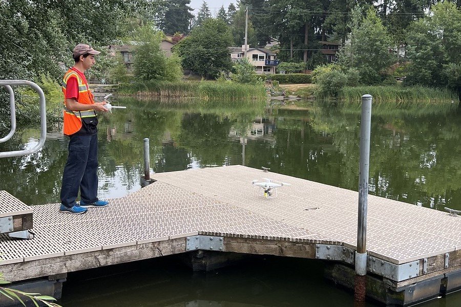
Typical water sampling can leave gaps in assessing entire bodies of water. Our multispectral camera was mounted to a UAS platform to calculate algae bloom indices of a lake.

What’s New
The Natural Hazards Center has opened applications for the Health and Extreme Weather Research Award Program, offering awards of $10,000 to $50,000 to support the collection of perishable, health-relevant data within six months of extreme weather events. This NIH-NSF funded program addresses critical gaps in knowledge about health risks and consequences associated with wildfires, hurricanes, droughts, floods, heat waves, and other extreme weather events. RAPID Facility users are particularly well-positioned to leverage this funding opportunity through our expanded portfolio of environmental health monitoring sensors and instrumentation, which enables comprehensive data collection at the intersection of extreme weather science and public health research. Researchers interested in applying should submit a 6-page single-spaced proposal following the submission guidelines, with questions directed to the Natural Hazards Center team at haz.research.awards@colorado.edu. This partnership between NIH and NSF enhances support for post-disaster investigations that integrate rapid reconnaissance with environmental exposure and health data collection.
The RAPID Facility is excited to announce that applications are now open for the 2026 RAPID Graduate Student Scholars Program! This annual program is designed to expand the next generation of natural hazards and disaster researchers by providing hands-on training, funding, and direct access to RAPID’s state-of-the-art field instrumentation and data collection resources.
Graduate student scholars receive a unique opportunity to develop expertise in collecting, processing, and publishing high-quality data that advance research across engineering, public health, and the social sciences. Through one-on-one training and supported field deployments, participants gain practical skills that strengthen both their research and future careers.
The RAPID Facility has released a new 4-page data brief providing a comprehensive overview of high-resolution aerial imagery and 3D models collected from the 2025 Los Angeles wildfires. This guide explains what makes the dataset unique, describes the three primary data products (orthomosaics, 3D point clouds, and digital surface models), and offers clear instructions for accessing the data through web-based tools and the NHERI DesignSafe Data Depot. The brief outlines how diverse users—from scientists and planners to educators and community members—can apply this building-level damage assessment data to wildfire risk reduction and community resilience work. Whether exploring the data for the first time or planning detailed analysis, this brief serves as an essential starting point for understanding this critical post-disaster dataset from the Palisades and Eaton Fire burn areas.


